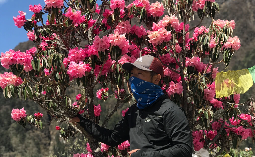
Manaslu Circuit Trek -15 days

Rating based on 3 verified reviews.Read all reviews
Things to Know
  • Duration15 Days
  • Difficulty Level Technical Challenging
  • Altitude 5,106m at Larkya la pass
  • Trip Type Trekking | Hiking
  • Start and End Kathmandu - Kathmandu
  • Best Time Mar-May, Sep-Nov
What You’ll Do
  • Cross the majestic Larkya La Pass (5,106 m) — one of Nepal’s most rewarding mountain passes.
  • Discover the Tibetan-influenced culture and lifestyle of the Manaslu region.
  • Witness spectacular views of Manaslu, Himalchuli, Ngadi Chuli, and Ganesh Himal.
  • Explore the Manaslu Conservation Area, home to the snow leopard and Himalayan tahr.
  • Visit the majestic, turquoise lake, Birendra Lake, located near Samagaon
  • Visit the Tibetan border from Samdo — a rare high-mountain experience.
  • Enjoy genuine tea-house hospitality while supporting local communities.

The Manaslu Circuit Trek is one of Nepal’s most stunning and remote trekking routes. It takes you through the beautiful Manaslu Conservation Area and parts of the Annapurna Conservation Area, offering breathtaking views of Mount Manaslu, the eighth-highest mountain in the world at 8,163 meters. This trek is perfect for adventurers seeking a less crowded route and the pristine beauty of an authentic Himalayan experience. The trek usually takes 13 days, starting at Machha Khola and ending at Besisahar. For those with more time, it can be extended to 22 days by adding a side trip to the culturally rich Tsum Valley. Along the way, you’ll pass through lush forests, terraced farmlands, and charming villages, all while enjoying incredible views of towering peaks like Ganesh Himal and Himalchuli. The journey begins in the warm lowlands, where you’ll walk through rice and millet fields. As you climb higher, the trail follows the Budhi Gandaki River, with its turquoise waters, dramatic gorges, and cascading waterfalls. The trek is also known for its thrilling suspension bridges, some of which are among the longest and highest in Nepal. One of the highlights of the trek is crossing the Larkya La Pass (5,106), near the Tibetan border. This high-altitude pass is often covered in snow and ice, and trekkers usually start early in the morning to avoid strong winds. The climb is challenging, but the views from the top are absolutely worth it. You’ll see incredible peaks like Cheo HimalHimlung Himal,Gyachung Kang, and Kang Guru, with glaciers flowing down their slopes. This breathtaking view is one of the most unforgettable moments of the trek. The Manaslu Circuit Trek is a true adventure, combining natural beauty, cultural immersion, and physical challenge. It’s a great choice for trekkers who want to explore Nepal’s unspoiled wilderness and experience the unique charm of the Himalayas.

Tibet Border Excursion

The Tibet Border Excursion is an optional one-day adventure from Samdo, adding one extra day to the standard Manaslu Circuit Trek. Because the area lies close to the Nepal–Tibet border, it is considered a more sensitive region and is designated as a restricted trekking area, requiring special permits and regulated access. There are no permanent settlements between Samdo and the border; the trail passes through remote Tibetan-style landscapes, high alpine pastures, rugged mountains, and dramatic Himalayan scenery. The round trip takes around 6–7 hours, returning to Samdo for the night, making it both a scenic adventure and a valuable acclimatization day before crossing Larkya La Pass (5,106 m).

Itinerary
Expand AllCollapse All

  • Altitude1,400m
  • AccommodationHotel
  • Time2-3 hours

Upon your arrival at Tribhuvan International Airport in Kathmandu, one of our representatives will warmly welcome you. You’ll be transferred to your hotel in our private tourist vehicle.

  • Altitude9,30 m
  • AccommodationTea House
  • Time8-9 hours

Starting the Manaslu Circuit trek begins at Kathmandu. There is a direct bus option from 6 a.m. and 8 a.m. at Gongabu Bus Park Kathmandu. From Kathmandu to Arughat Bazaar is a 6 to 7-hours comfortable drive on a concrete paved road. After this is a bumpy and winding dirt road to Machha Khola which takes from 3-4 hours depending on the traffic and road condition. Machha Khola is a small village in the Gorkha district of Nepal, located at an altitude of approximately 930m. It is a significant stop along the Manaslu Circuit Trek, nestled on the banks of the Budi Gandaki River

  • Altitude1,340 m
  • AccommodationTea House
  • Time6-7 hours

Our trek begins today. After breakfast, we cross the Machha Khola River and walk toward a small settlement of Khorlabesi. From here, we continue northward passing through the natural hot springs at Tatopani. After a short walk through the thick woods, we reach a village called Dobhan. We continue our walk for a while. After crossing the river on a suspension bridge we reach the beautiful village of Jagat.

  • Altitude1,860 m
  • AccommodationTea House
  • Time6-7 hours

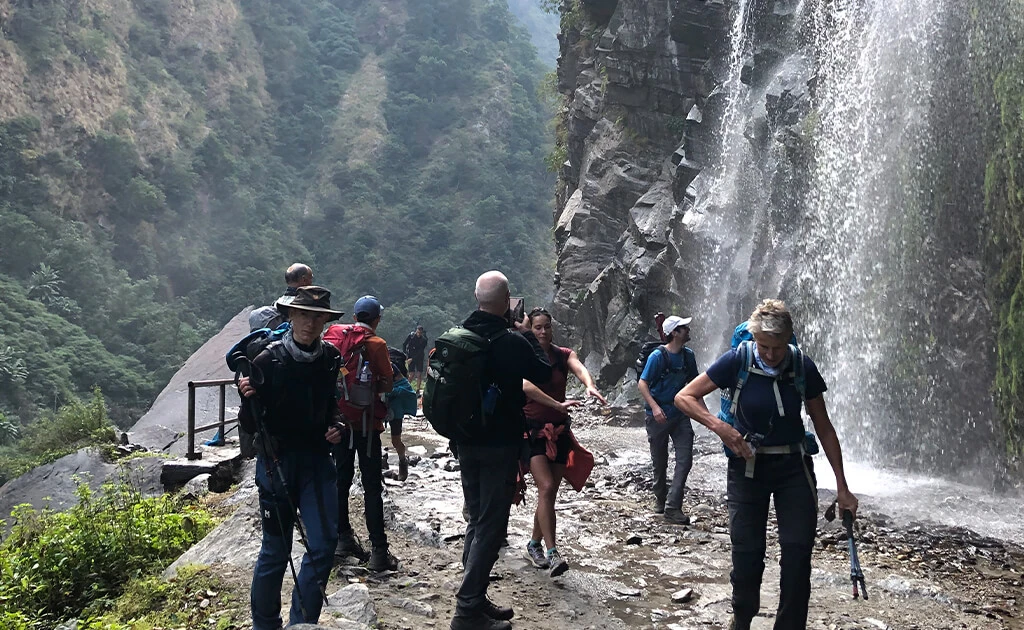
After Jagat, we walk down to the river and follow its course on the trail that passes through beautiful terraced fields. Passing through the village of Sulleri, we see Philim far in the distance. A walk of about two hours from here will take us to Philim. Philim is comparatively a larger settlement on the trail. Leaving Philim, we continue on the main trail. The walk is pleasing and you will be rewarded with the view of waterfalls cascading down in Budhi Gandaki on both sides of the trail. We cross the river many times and sometimes go high above it. After a walk of around four hours from Jagat, we reach our first Kani -- a stone arch -- of the trek. Deng is the next settlement that we see in the trial.

Note: Your Restricted area permit has to be checked at the check post. From this day you will walk in the prohibited area until Bimthang 

  • Altitude2,630 m
  • AccommodationTea House
  • Time7 hours

We continue the walk after having breakfast at our lodge. The walk is more or less similar. Descend to the river, cross it, and climb high above the river. After nearly three hours of trek, we reach a village named Ghap. Take some time to look out for the beautiful Kani as well as the mani wall. From here, the trail is through thick woods of pines, rhododendrons, and bamboo. Look out for monkeys. The village of Namrung welcomes you once you are done with the forested trail.


  • Altitude3,500 m
  • AccommodationTea House
  • Time6 hours

The first settlement that we come across today is Lihi Gaon. This village has numerous chhortens and intricately woven mani walls. Take some time to observe these ancient artworks. If the weather is good, you can get a clear view of Mt. Manaslu and other neighbouring peaks today. From here, we stop at Sho, which offers stunning views of Manaslu. We continue our walk northward. After crossing another bridge, we reach the village of Lho. After leaving the village, Ngadi Chuli emerges right ahead of us. The settlement of Shyala is not so far.

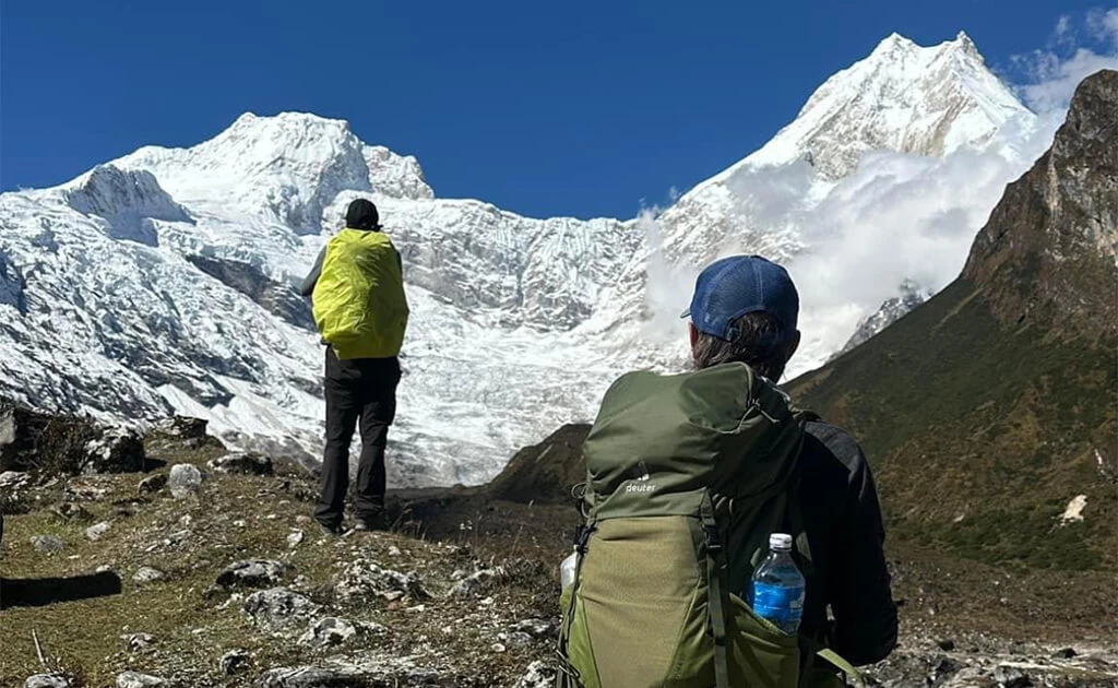
Note: As you journey from Namrung to Shyala, the landscape unfolds into wide, open valleys offering spectacular Himalayan panoramas. The highlight of this section is the magnificent Mt. Manaslu (8,163 meters / 26,781 feet) — the world’s eighth-highest peak. Its dazzling snow-clad slopes dominate the horizon, first appearing majestically near Lho and becoming even more awe-inspiring as you reach Shyala, standing as the true crown of the Manaslu region

  • Altitude3,530 m
  • AccommodationTea House
  • Time3 hours

The walk is shorter today. Leaving Syala, we follow the moraine of Pungen Glacier toward Sama Gaon. On the trail, we can enjoy amazing landscapes and excellent scenery. There is a beautiful monastery in the village. The monastery offers stunning views of Manaslu and other peaks. After lunch, we will explore the village.

Note: Sama Gaun is the principal village of the Nubri people. It has a large gompa, many shops, a health post, a heliport, telephone/Wi-Fi access


  • Altitude4800 m
  • AccommodationTea House
  • Time7-8 hours

Today is a rest and acclimatization day to help your body adjust to the high altitude. You can take an acclimatization hike to Pungyen Gompa, located east of the Nubra Valley. Remember to carry a packed lunch. From the hilltop, enjoy stunning views of Mt. Manaslu and spot Himalayan yaks and thar grazing nearby. 

In the course of exploring, You can either visit Pungyen Gompa and glacial Lake Birendra Tal (4-5 hours) or you can take a walk to Manaslu Base Camp and return to Samagaon (7-8 hours).

The Pungyen monastery is situated on the southern slope of Mt Manaslu, the eighth-highest mountain in the world 8,163 meters (26,781 feet). However, the monastery itself lies at an approximate altitude of 4,700 meters  offering a clear view of this towering peak. From Samagau, the distance to Pungyen monastery is approximately 14.5 km.  It is one of the oldest and most revered religious sites in the region, deeply tied to the Tibetan Buddhist culture and traditions of the local people. The name “Pungyen” is derived from the Tibetan word for happiness, and the gompa is seen as a symbol of peace and prosperity.

  • Altitude3875m
  • AccommodationTea House
  • Time2-3 hours

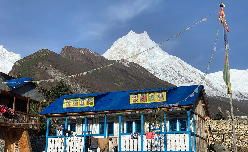
On this day, you’ll reach Samdo, one of the highest villages on the Manaslu Circuit. Since it’s a high-altitude day, the trek is short and easy, giving your body time to adjust. Continuing further, we reach Samdo. Samdo is a small remote settlement of about forty houses before crossing the Larkya La Pass and is inhabited by a Tibetan community that has preserved its traditional way of life. Once at Samdo, you can explore the nearby villages or hike to Samdo Peak. The Larkya La trail is on the left above the valley. 

  • AltitudeRui La Pass 4,998 m
  • AccommodationTea House
  • Time5-6 hrs

This is our 2nd acclimatization day of the trip to prepare your body for the high-altitude challenge of crossing Larkya La Pass. From the village of Samdo (3,860 meters), you will set out on a spectacular side hike to the Rui La Pass (4,998 meters), a historic trade route that once connected Nepal with Tibet. This trek to the border offers an enriching cultural and scenic experience while helping your body adapt to the thinner mountain air. As you stand near the Nepal-Tibet border at 4998 meters, you will get a rare glimpse into a remote and culturally significant region few travelers reach. After soaking in the views and snapping unforgettable photos, you will return to Samdo for a hot meal and well-earned rest in your cozy tea house. At the end, this side trip gives you the altitude boost needed for a safe and successful ascent over Larkya La.

  • Altitude4460 m
  • AccommodationTea House
  • Time5 hrs

Today your journey to Dharmasala (4,460 meters), also known as Larke Phedi, the final overnight stop before tackling the challenging Larkya La Pass. Though you will only cover 5.5 kilometers  today, the trail becomes steeper and the air thinner as you climb further into the high-altitude alpine zone. The path winds through rocky terrain and barren hillsides. Despite the short duration, about 5 hours, today's journey is physically demanding due to the elevation gain and decreasing oxygen levels. As you reach Dharmasala, a basic resting point for trekkers, you will notice the terrain becoming stark and remote. The settlement here only consists of a few stone lodges and tents, run seasonally by locals. The facilities here are modest, but the dramatic mountain surroundings compensate for the simplicity.

  • AltitudeLarkya Pass (5106m)
  • AccommodationTea House
  • Time10 hours

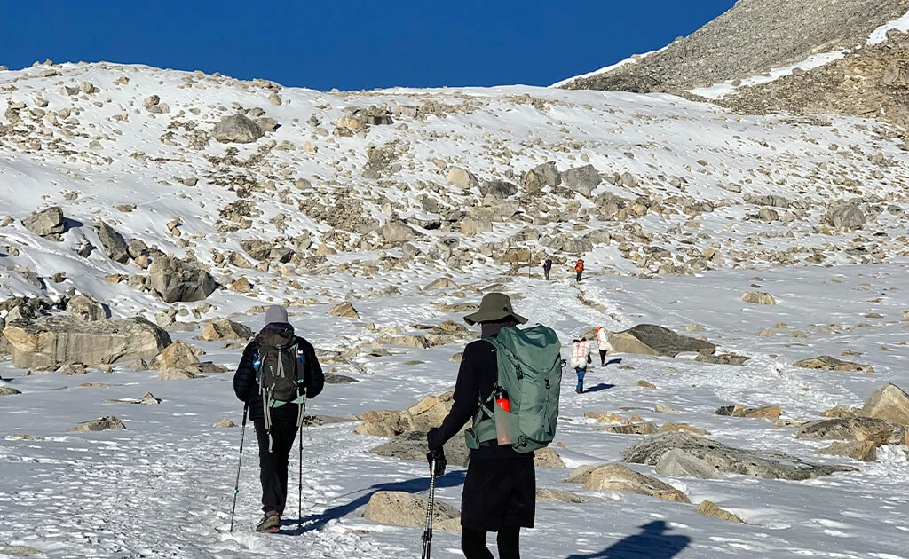
We will start as early as possible today to escape the chilly winds that might blow throughout the middle of the day at high altitudes. It is a very important and difficult day in our trekking journey as we embark on a mostly rocky trail steadily for about 3 hours. We first climb towards Cho Chanda followed by a steeply uphill journey towards the exhilarating pass. The strategy to reach Larkya La Pass (5,160 m/16,929 ft) is to go slowly and steadily. Accompanied by the phenomenal view of Himlung Himal (7,126 m/23,379 ft), Cheo Himal (6,820 m/22,375 ft), Gyagi Kung, Kang Kuru (6,981 m/22,903 ft), and Annapurna II (7,937 m/26,040 ft), we cross the steep slope descending towards Bhimthang. The tranquil valley of Bhimthang surrounded by grazing yaks and dramatic landscapes is sure to leave you awestruck.

  • Altitude1860m
  • AccommodationTea House
  • Time7-8 hrs

On the last day, descend through green forests and rhododendron bushes. Stop for lunch at Karche, cross the Dudh Khola, and pass through Gurung Gaon. Eventually, you will reach Goa (also spelled Gho), a quiet village nestled within terraced fields and forested slopes. Continue along the valley fields to reach Dharapani, marking the end of your trek.

  • Altitude1400m
  • Accommodation3 star Hotel
  • Time10 hrs

Today is a long drive. You’ll take a jeep from Dharapani to Besisahar, where the road is rough, so the journey may take longer. From Besisahar, continue to Kathmandu, which usually takes around 6 hours. Once in Kathmandu, you can rest and relax at one of the city’s comfortable hotels. Depending on your group size, a shared or private jeep will be arranged from Dharapani to Besisahar. From Besisahar, you will continue your journey to Kathmandu by tourist bus.

    The trip concludes – Our staff  will arrange your airport drop-off according to your flight schedule. 

    Iconic Holiday Nepal standard itinerary might differ slightly due to unpredictable happenings. Factors such as flight cancellation/delay, unfavourable weather, natural calamities, newly implemented government rules, political affairs, trekkers’ health conditions, etc., are possible. In these times, we look for your cooperation and flexibility. While on the trip we get to marvel at the magnificent views of Mt. Manaslu (8163m), the eighth-highest mountain in the world, coupled with a chance to witness the rich local heritage and biological diversity of the region. The highest point in this trek is the ‘Larkya La Pass’ which is widely believed to be one of the most dramatic passes crossing the Himalayas. 

    Trip Map
    Manaslu Circuit Trek -15 days map
    Trip Cost Details
    Included
    • All (international and domestic) airport transfers on a tourist vehicle
    • Accommodation 3 star hotel in Kathmandu including breakfast
    • Twin-sharing guesthouse accommodation during the trek in the Manaslu region
    • All your standard meals during the trek (Breakfast, Lunch, and Dinner) and seasonal fruits
    • Surface transfer from Kathmandu to Machha Khola by bus |  Private jeep services with extra cost
    • Dharapani to Besahar via shared jeep, then via tourist bus to Kathmandu
    • Manaslu Conservation Area Permit (MCAP), Annapurna Conservation Area Permit (ACAP) and Restricted Area fee for trekking
    • Experienced, first-aid trained, government-licensed, guide
    • Porters during the trek for carrying luggage (1 porter for every 2 clients)
    • Wages, accommodation, meals, gear, insurance, and medications for all staff
    • Rescue operation arrangements in case of complicated health conditions (funded by travel insurance)
    • Iconic Holiday Nepal trek achievement certificate after the successful trek
    • All administrative expenses and government taxes
    Excluded
    • International flight fare and airport departure tax
    • Nepal Entry Visa Fee | Nepal Travel Information
    • Meals (lunch and dinner) in Kathmandu
    • Travel insurance along with high-altitude emergency evacuation coverage
    • Tips to trekking staffs
    Useful Info

    Best Time to Trek

    The best time for the Manaslu Circuit Trek is spring (March–May) and autumn (September–November). Autumn, particularly October, usually offers the clearest mountain views, dry trails, and stable conditions for crossing Larkya La Pass (5,106 m). Spring is equally beautiful, with blooming rhododendrons, fresh greenery, and pleasant trekking temperatures. Nepal Tourism Board also recommends March–May and September–November for the Manaslu region. Monsoon can bring heavy rain, muddy trails, landslides, and transport disruptions, while winter brings very cold conditions and increased snowfall around the high pass.
    Best Views and Scenic Adventure

    The Manaslu Circuit Trek is one of Nepal's most rewarding scenic adventures, gradually changing from green hills and subtropical forests to dramatic alpine landscapes. The trail follows the Budhi Gandaki Valley, crossing suspension bridges, waterfalls, narrow gorges, traditional villages, and beautiful Himalayan valleys. Major highlights include Mount Manaslu (8,163 m), Manaslu Base Camp (4800m), Birendra Lake, Pung Gyen Gompa, Sama Gaon, Samdo, Dharamsala, and the spectacular Larkya La Pass. From the higher trail, trekkers can enjoy impressive views of Manaslu, Himalchuli, Ngadi Chuli, Ganesh Himal, Himlung, and surrounding peaks.

    Transportation

    The classic Manaslu Circuit Trek starts from Machha Khola. From Kathmandu, you can travel by local bus, shared jeep, or private 4WD jeep, depending on your budget and comfort. A private jeep provides greater flexibility, while local transportation is a more economical option. After completing the trek at Dharapani, a local shared jeep takes you toward Besisahar, from where you can continue to Kathmandu by tourist bus or private vehicle.

    Accommodation and Foods

    Accommodation on the Manaslu Circuit is mainly provided by family-run teahouses and mountain lodges. Rooms are generally simple with twin beds and shared bathroom facilities. Lower villages have relatively better facilities, while accommodation becomes increasingly basic in Samdo, and Dharamsala. Hot showers, Wi-Fi, and charging are usually available for an additional fee, but facilities become limited at higher elevations. Carrying a good sleeping bag is recommended. Food is an important part of the Manaslu Circuit Trek, with teahouses offering a variety of fresh, filling, and mostly simple meals. Dal Bhat (rice, lentils, vegetables, and curry) is the most popular choice among trekkers, along with momos, noodles, pasta, fried rice, Tibetan bread, soups, potatoes, eggs, pancakes, and porridge. Hot tea, coffee, ginger tea, and soup are also widely available and are especially enjoyable in the cold mountain environment. For extra energy during long trekking days, carrying snacks such as chocolate, nuts, energy bars, and dried fruits is recommended.

    Mobile Network and Wi-Fi

    Connectivity is limited but available in parts of the Manaslu region. Nepal Telecom (NTC) generally provides better coverage than other networks on the trekking route. Wi-Fi can be found at some teahouses in places such as Machha Khola, Jagat, Deng, Namrung, and Sama Gaon, but the connection can be slow and unreliable. Around Samdo and Dharamsala, connectivity may be very limited or unavailable. It is wise to buy an NTC SIM card in Kathmandu and carry a fully charged power bank. Trekkers should also inform family members that communication may be unavailable for periods during the high-altitude section.

    Emergency and Trekking Safety

    The Manaslu Circuit is a remote high-altitude trek, so proper preparation is important. The major concerns include altitude sickness, rapidly changing mountain weather, snow around Larkya La, and difficult or remote trail sections. Travel with a qualified trekking guide, follow a gradual acclimatization schedule, stay hydrated, and avoid rushing at high altitude. Travel insurance covering high-altitude trekking and emergency evacuation is strongly recommended. Because Manaslu is a restricted trekking area, foreign trekkers must obtain the required permit through a registered trekking agency under the current Department of Immigration regulations

    FAQs
    • Nepal’s Government has declared the Manaslu Region (between Jagat and Sama Gaun) a restricted area to control tourism in the region. As a result, independent trekkers are not allowed in Manaslu, and trekkers are subject to obtaining a special entry permit. The government rules also state there must be a minimum of two trekkers in a group, accompanied by a local guide. Additionally, your permit must be processed through a registered agency. Three different permits are required for the trek.
      1. Special Restricted Area Permit for Manaslu (Manaslu RAP)
      This permit is necessary while travelling from Jagat to Sama Gaun. The area from Jagat to Sama Gaun and the villages in between are restricted.
      September to November: USD 100 per person for the first seven days and an additional USD 15 per person per day from the eighth day onwards.
      December to August: USD 75 per person for the first seven days and an additional USD 10 per person per day from the eighth day onwards.
      2. Manaslu Conservation Area Project (MCAP Permit): This Manaslu trek permit is required from Philim, where the Manaslu Conversation Area starts
      The price is the same throughout the year: USD 30 per person. Also, there is no restriction or change in price with a change in the number of days you spend inside MCAP.
      3. Annapurna Conservation Area Project (ACAP Permit): Annapurna Conservation Area Permit is required from Dharapani until you exit to ACAP in Beshi Sahar. The price is the same throughout the year: USD 30 per person. Also, there is no restriction or change in price with a change in the number of days you spend inside ACAP.

      Note: If you want your trip to extend to Tsum Valley, you will need a Tsum Valley permit as well. This permit will cost USD 40 per person for one week from September to November. From then on, it costs USD 7 per person per day. Moreover, This permit will cost USD 30 per person for one week from December to August. From then on, it costs USD 7 per person per day.
      Note: TIMS(Trekkers Information Management System) Card is a must for foreign trekkers in Nepal. However, you do not require that permit on Manaslu Trek. The ACAP, MCAP, and Manaslu Restricted Region Permit are enough for the Manaslu Region.
      Note: For a Manaslu restricted area permit you need an authorized trekking agency and it is obtained from the Department of Immigration. Manaslu Area Conservation Project (MCAP) Permit and Annapurna Conservation Area Project (ACAP) Permit can be obtained from the Nepal Tourism Board Office at Bhrikutimandap.

    • Manaslu circuit trek difficulty is challenging. The terrain is rough and steep and crosses a high pass. Larke La Pass (5,106m) is one of the world's longest Himalayan pass.  Likewise, the region is very remote, and the high elevation makes the journey more difficult. This trek is only for experienced trekkers or individuals who are very fit. 

    • The Manaslu Circuit trek goes from 14 to 18 days, depending upon the itinerary. Our itinerary is 14 days long. We also organize short manaslu circuit treks for travellers with limited time. This trek encircles the eighth-highest mountain in the world, Mount Manaslu, in the Nepalese Himalayas. The trek offers stunning views of the mountains, diverse landscapes, and a chance to experience the local culture of the region.

    • The highest point during the Manaslu circuit trek is Larkya La Pass at 5,106 meters (16,752 ft) above sea level. For more information click the link Larkya La Pass.

    • The Manaslu Circuit Trek begins with the scenic drive from Kathmandu to Arughat and finally to Machha Khola. which is situated 160 KM from Kathmandu. From Kathmandu, you can take a bus ride to the starting point of the trail. It takes an entire day to reach the trekking region. On the second day, the trek truly begins as we leave Machha Khola, The Manaslu circuit trek begins from Machha Khola.

    • Yes, it is advisable to carry a sleeping bag for the Manaslu Circuit trek, as you will be staying in teahouses along the route, especially in the higher altitudes. While teahouses do provide basic bedding, having your own sleeping bag ensures that you are warm and comfortable, especially during colder nights at higher elevations. Make sure your sleeping bag is suitable for cold weather conditions, as temperatures can drop significantly, especially at night.

    • Internet access during the Manaslu Circuit trek can be limited and unreliable, especially in the remote mountainous regions. While some teahouses and lodges along the route may offer Wi-Fi services, the connections are often slow and may not be available consistently. Many trekkers opt for local SIM cards with data plans before starting the trek, but be aware that the coverage may still be spotty in the mountainous areas.


    • Charging facilities are available in most teahouses along the Manaslu Circuit trek, but they usually come at an extra cost. You can charge your electronic devices such as phones and cameras, but it's advisable to bring a portable power bank to ensure you have power during the trek, especially in case there are limited charging outlets. Hot shower facilities are also available in many teahouses, but again, they often come at an extra cost. Some teahouses may use solar heaters for hot water, so the availability of hot showers can be influenced by weather conditions and the time of day. These expenses are not covered in our package cost, so carry some extra Nepali cash with you while trekking.

    Client Reviews
    • Patrick t
      Patrick tMalaysiaDec 20, 2025

      Manaslu Circuit Trek

      The best experience Ever have in Nepal for Manaslu circuit trek , i would to highlights Iconic holiday for its perfect arrangement and also its hospitality and most satisfying service

      TripAdvisor
    • Odyssey65271671082
      Odyssey65271671082IndiaMay 12, 2025

      A wonderful experience with Iconic Nepal

      We did Manaslu Circuit Trek with Iconic Nepal and it was very well curated plan by Upendra. He provided very professional and friendly guide and porter. They both took good care of us. We had a chance to meet his family and spend some time with them which was really nice. Overall I would say this is the best and reasonable company to do treks in Nepal.

      TripAdvisor

    Our global team of experts is here to assist you.

    Need Travel Advice